Skip to header Skip to main navigation Skip to main content Skip to footer

Photo Galleries (* = with music)

  • Laguna Beach 2017
  • Fitz and Makenna ... January 2017
  • Rhythm Collision 2017 Riverside CA.
  • Shari and Dick's 50th Anniversary
  • Jim Woodruff Memorial Ride
  • Avignon and Palace of the Popes
  • Nyons and Ventoux
  • Cote d'Azur
  • Paris: Seine, Louvre, D'Orsay and Pompidou
  • Paris: Cluny and Notre Dame
  • Paris: Bustour and Opera
  • Paris: Louis Vuitton Gallery
  • Paris: Carnavet and Boat Tour
  • Sydney
  • Wine Tour
  • Cairns
  • Rainforest
  • Botanic Gardens
  • Melbourne
  • Tasmania #1
  • Tasmania #2
  • Chile
  • China Beijing
  • China Great Wall
  • Xi'an
  • Xian Museum
  • Luoyang Grotto
  • Terracotta Warriors
  • Pandas
  • Lhasa Tibet
  • Yangtze River
  • Tibetan Museum
  • Shanghai
  • California 2010
  • Toronto and family pictures from 2013
  • House Pets Trips (many)
  • Cadillac Mt. Maine 2001
  • Hang Down (Blue Ridge Trip 2003)
  • 2014 Family, Block Island, bike
  • Huntington Gardens 2008
  • North Carolina Trip 2010
  • 2010 Home and Family
  • Laguna Beach 2012
  • Laguna Beach 2015
  • Laguna 2016 *
  • 2011 New Bike and California
  • Corning Glass Museum 2015
  • Older Family Pictures to 1947
  • Charles and Nancy visit 2011
  • Dumbarton and wedding 2009
  • Eric and Lillian's 2010 visit
  • Family Reunions 2014 and 2010
  • Family: Reunion, at Virginia's and more
  • Sue and Bill's Wedding 2006
  • Sue's Pictures
  • Old Bikeclub Pictures
  • Bikeclub Spring 2009
  • Bikeclub Brunswick 2009 Boehm Ride 2015
  • 2009-2010 Including a few at Sharis
  • Greylock 2005
  • Greylock 2009
  • Greylock 2013
  • Greylock 2014
  • Runners September 2006
  • Runners 2013
  • Runners December 2006
  • Runners Miscellaneous
  • Runners December 2011
  • Runners Bob Flick's Party
  • Runners - Tom Corrado Pics
  • Time the Conqueror *

3. Ride with GPS -- features other than route creation

Rwgps is a full featured web site has many capabilities beyond route creation and management.  We will look at a few here.  But before we do, please note that rwgps has a very nice help system of its own.  Just hit HELP from the top menu line of most screens and you will see the help options. 
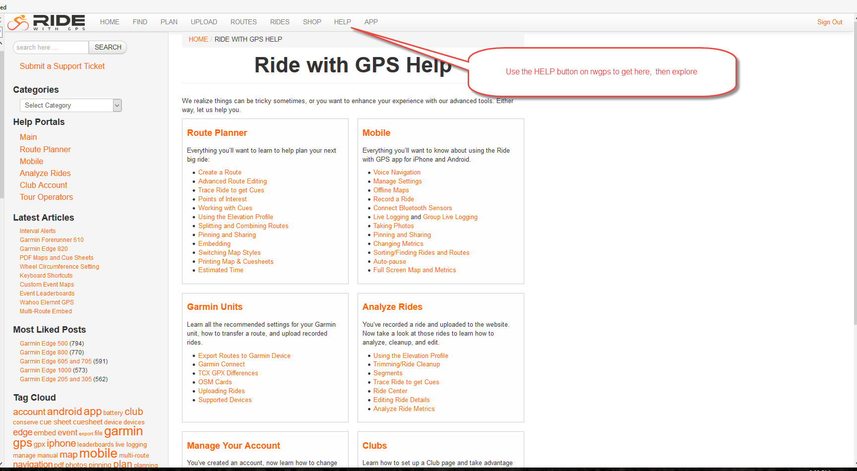
130.jpg

With that said, some of the capabilities you might be interested in include:

  • store records of your rides and be able to analyze them
  • create segments (KOM) points and compare results both for yourself and for other riders
  • find rides and routes in your area or in areas that you are visiting
  • download routes to a GPS device (Garmin or smartphone)
  • get turn by turn instructions while you are riding (also, Garmin or smartphone)
 

rwgps
  • Read more about 3. Ride with GPS -- features other than route creation

2. Ride with GPS -- MHCC Club page

To join the MHCC club on Ride with GPS (rwgps), first you create a rwgps username.  Even a free basic username will work.  Then contact me (fkelly12054@gmail.com), tell me your rwgps username and I'll send you a link.  Most people taking this class live will already be members.  One of the advantages of the club area is that even free basic usernames in rwgps can use the Print to PDF capabilities when they are on the club page.  Using that requires a paid membership elsewhere on rwgps.

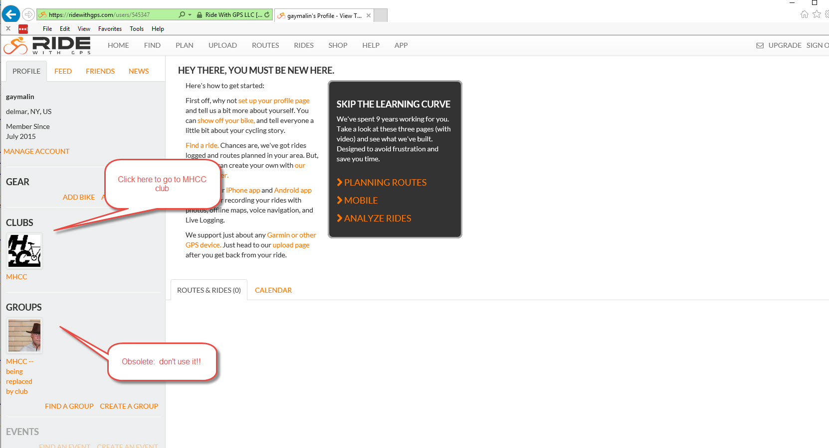
Once you have joined the MHCC club page on Ride with GPS (rwgps), you can access it whenever you sign on by going to home/ profile and clicking on the club link as shown here:

100.jpg

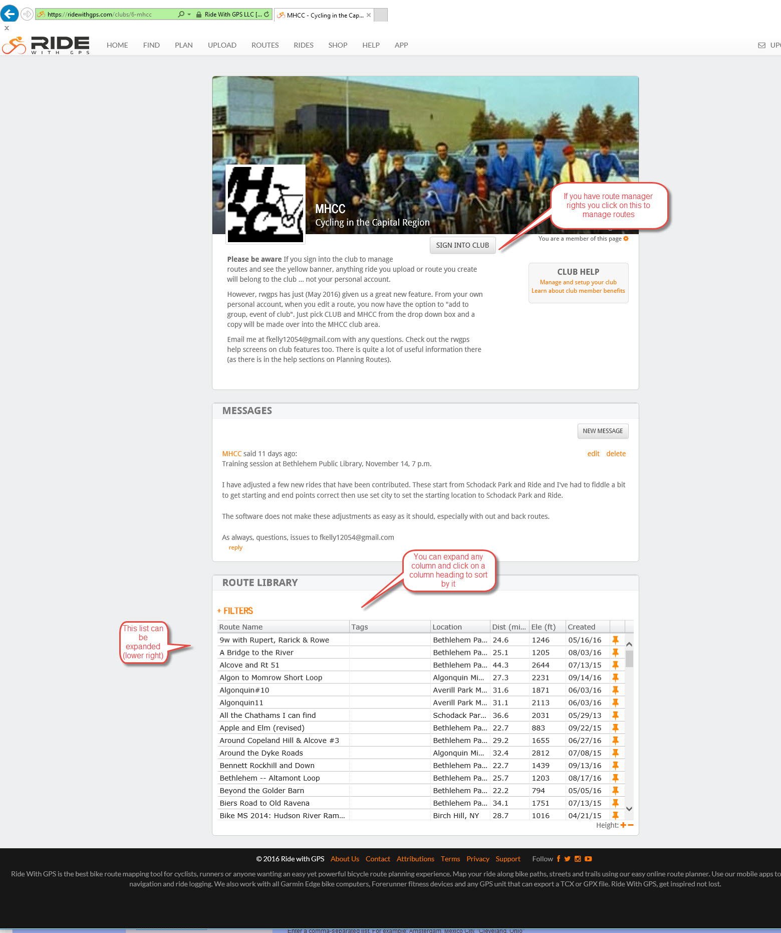
When you come to the club page, you should see something like this:

110.jpg

rwgps
  • Read more about 2. Ride with GPS -- MHCC Club page

1. Ride with GPS -- route creation and editing

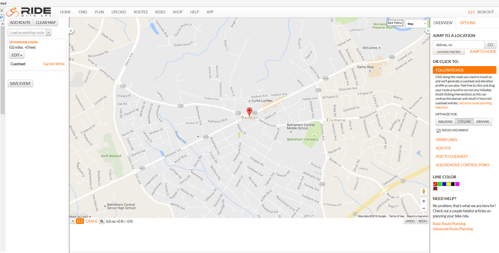
To start a route, hit PLAN from the main menu, then type an approximate location into the "Jump To A Location" drop down box (right of screen).  This will get you to the general area of your route ... then scroll the map to the exact location ... in this case the Bethlehem Park and Ride.

05.jpg

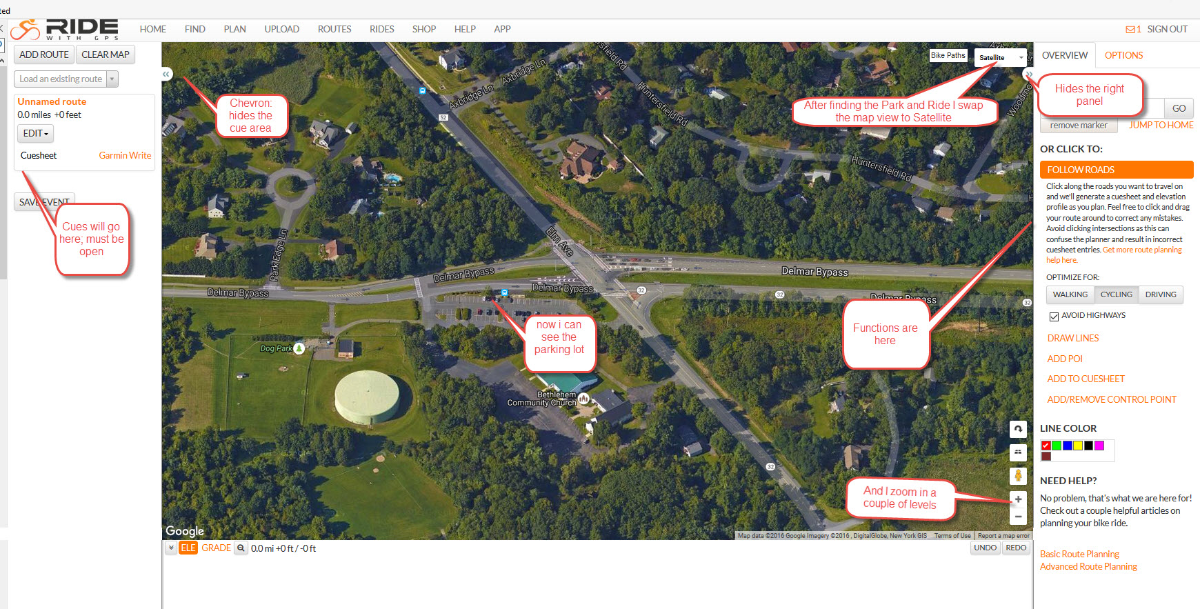
Once you find the starting location, click on Satellite for the map style (upper right) and zoom in a couple of levels so you can see the parking lot clearly.  The + zoom button is lower right.  The screen below is annotated to show different features that will be discussed.

10.jpg

rwgps
  • Read more about 1. Ride with GPS -- route creation and editing

Making Ride With GPS routes start and end in Parking Lots

Very brief introduction.  Ride With GPS (rwgps) is a bicycle route mapping product and web site that our bike club is using to generate maps and cue sheets for routes.  These need to be accurate and reliable.  This article is written for ride leaders who are developing routes on rwgps and already have some familiarity with the product.  The rwgps web site has plenty of introductory material, including videos, on developing and modifying routes.  Here we are focusing on a common problem:  getting routes to start and end in parking lots accurately.

Here's the deal.  RWPGS uses software by Google, OpenStreetMaps and others.  This software primarily focuses on ROADS!  A parking lot is not a road.  Neither is a bike path or rail trail or the woods.  To make a route use a parking lot or rail trail, you need to use the draw lines tool and know how to integrate that tool with the follow roads tool as well as strategic placement of control points and manual entry of cue sheet entries.  It gets a bit difficult at times, especially if you are fixing up a route that was not done perfectly in the first place.

rwgps
  • Read more about Making Ride With GPS routes start and end in Parking Lots
Subscribe to rwgps

Copyright © 2026 Company Name - All rights reserved

Developed and Designed by Alaa Haddad at Flash Web Center, LLC