1. Ride with GPS -- route creation and editing
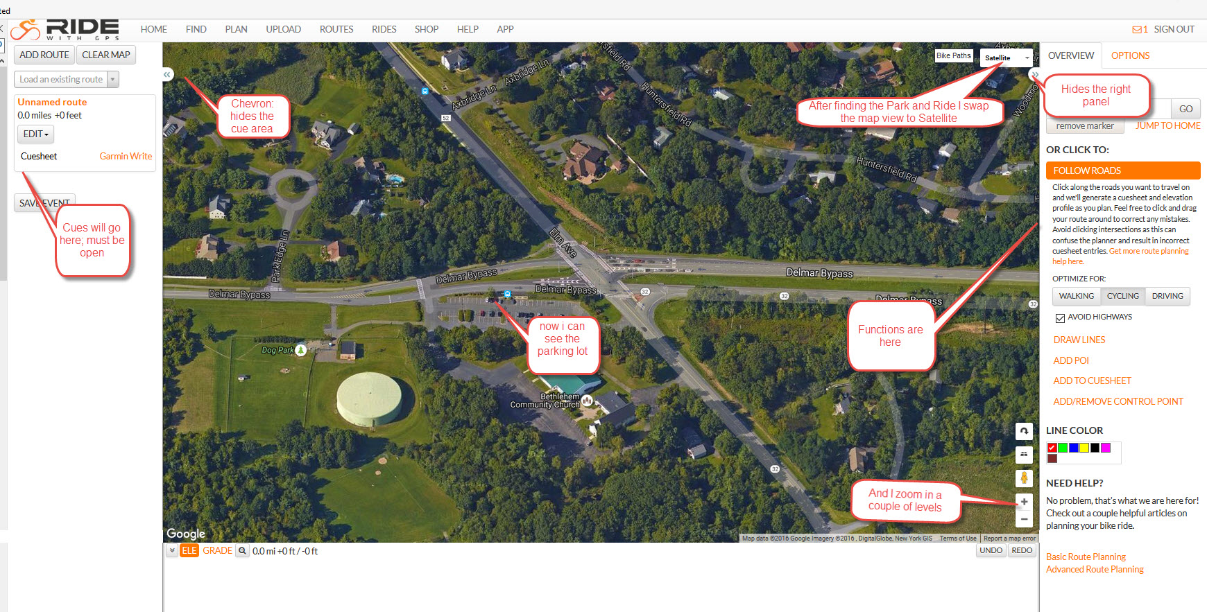
To start a route, hit PLAN from the main menu, then type an approximate location into the "Jump To A Location" drop down box (right of screen). This will get you to the general area of your route ... then scroll the map to the exact location ... in this case the Bethlehem Park and Ride.
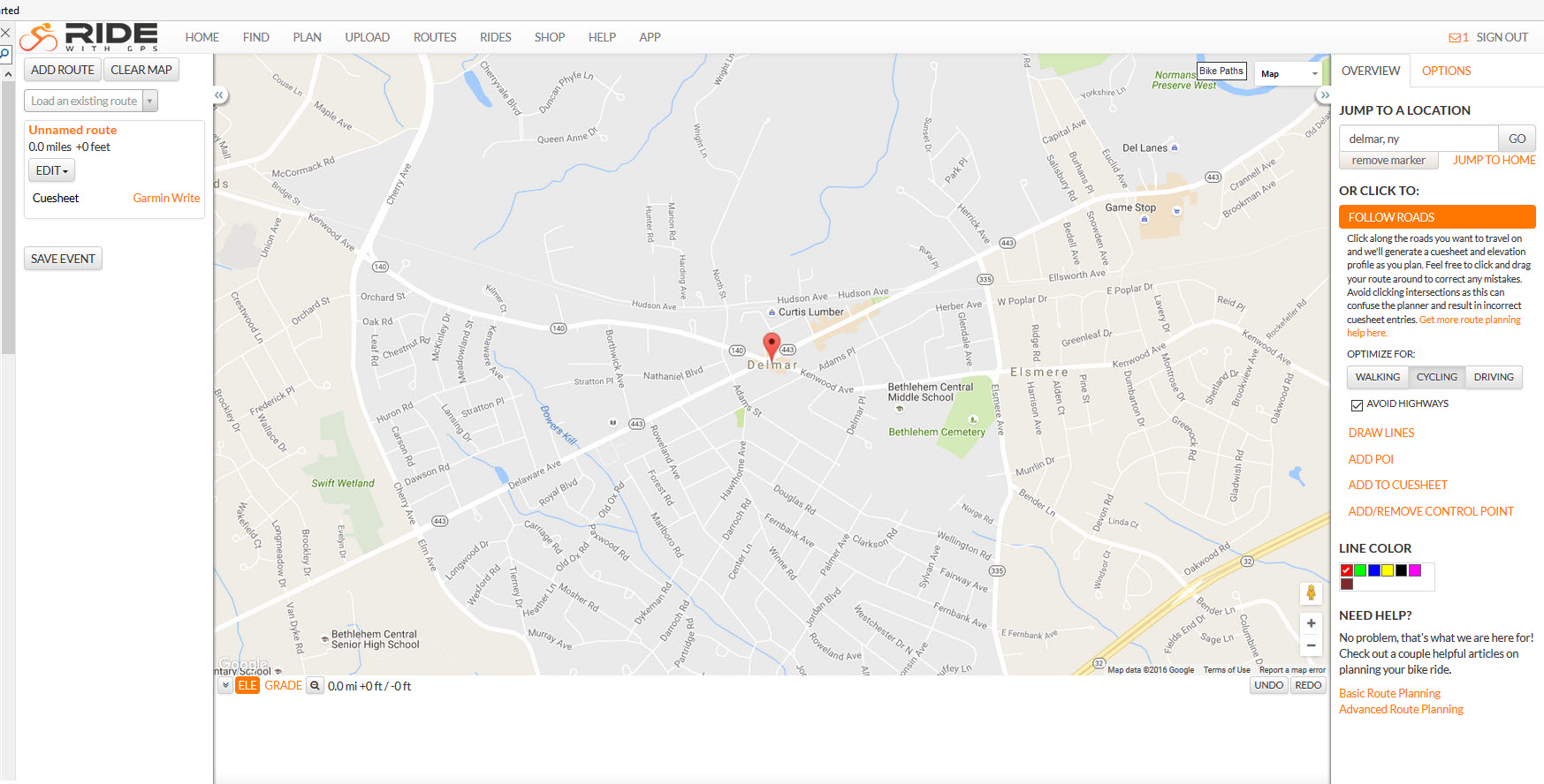
Once you find the starting location, click on Satellite for the map style (upper right) and zoom in a couple of levels so you can see the parking lot clearly. The + zoom button is lower right. The screen below is annotated to show different features that will be discussed.